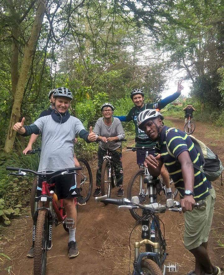
Loading African Treks and Cycling Safari
The Shira Route approaches Mount Kilimanjaro from the western side and begins at a higher elevation than most other routes. Starting from Londorosi Gate, climbers are driven through the rainforest and heather zones to Shira One Camp on the scenic Shira Plateau. Due to its high starting point, this route is best suited for trekkers with previous high-altitude experience or those seeking a shorter Kilimanjaro climbing itinerary.
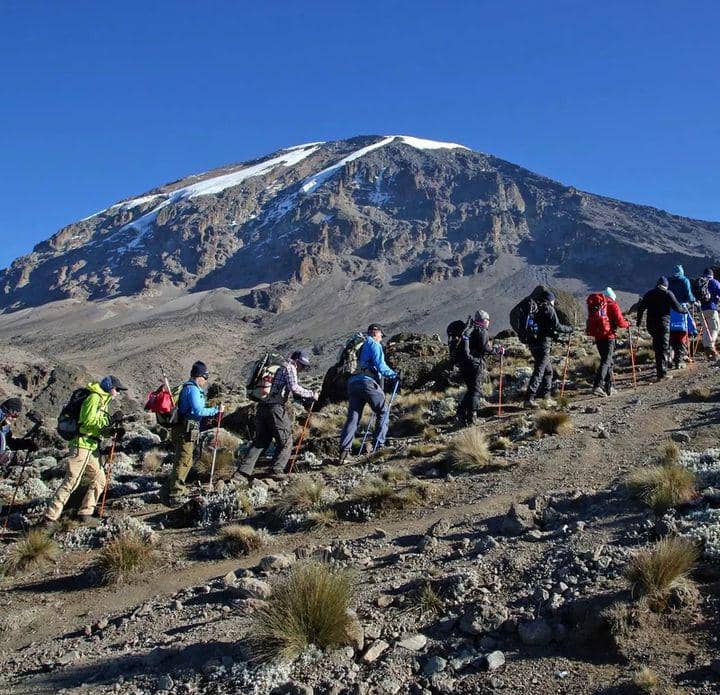
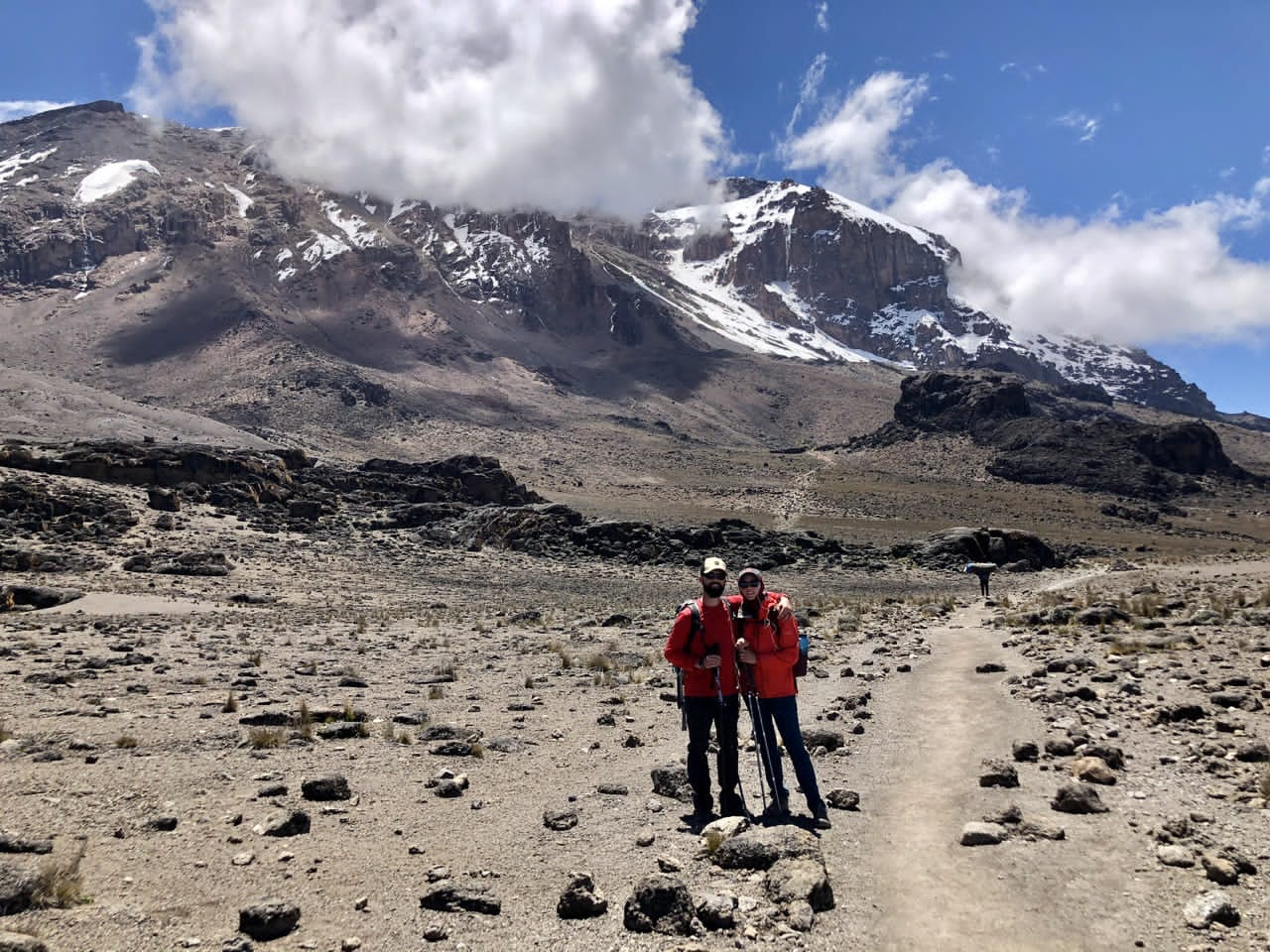
From Shira One, the trail joins the Lemosho Route and continues across the breathtaking Shira Plateau to Shira Cathedral and Shira Two Camp. The journey then ascends to Lava Tower before descending into the spectacular Barranco Valley, one of the most beautiful sections of the mountain. Climbers tackle the famous Barranco Wall and follow the Southern Circuit through Karanga Camp before reaching Barafu Hut, the base camp for the summit attempt. Climb Mt.Kilimanjaro 6 Days Shira Route is more demanding because it offers less time for acclimatization, making altitude adjustment more challenging than longer itineraries.
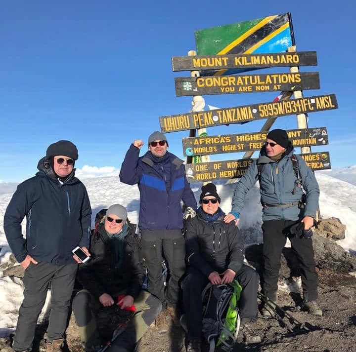
The summit ascent begins from Barafu Hut in the early morning hours, often under a full moon. This is the coldest and windiest stage of the trek, but climbers are rewarded with a stunning sunrise near Uhuru Peak (5,895m), the highest point in Africa. After reaching the summit, the descent follows the Mweka Trail via Barafu Camp and Mweka Hut, bringing this unforgettable Kilimanjaro adventure to a successful conclusion.
For Complete Itinerary and Details for the 6-Day Kilimanjaro Climb via the Shira Route, click the link below.
DAY-1 : MOSHI TOWN-LONDOROSSI GATE TO SHIRA ONE.
Starting elevation 900m Moshi Town.
Ending elevation 1800m Londorosi Gate.
Altitude gain 900m.
Driving distance 85kms.
Driving hours 2-3 Hours.
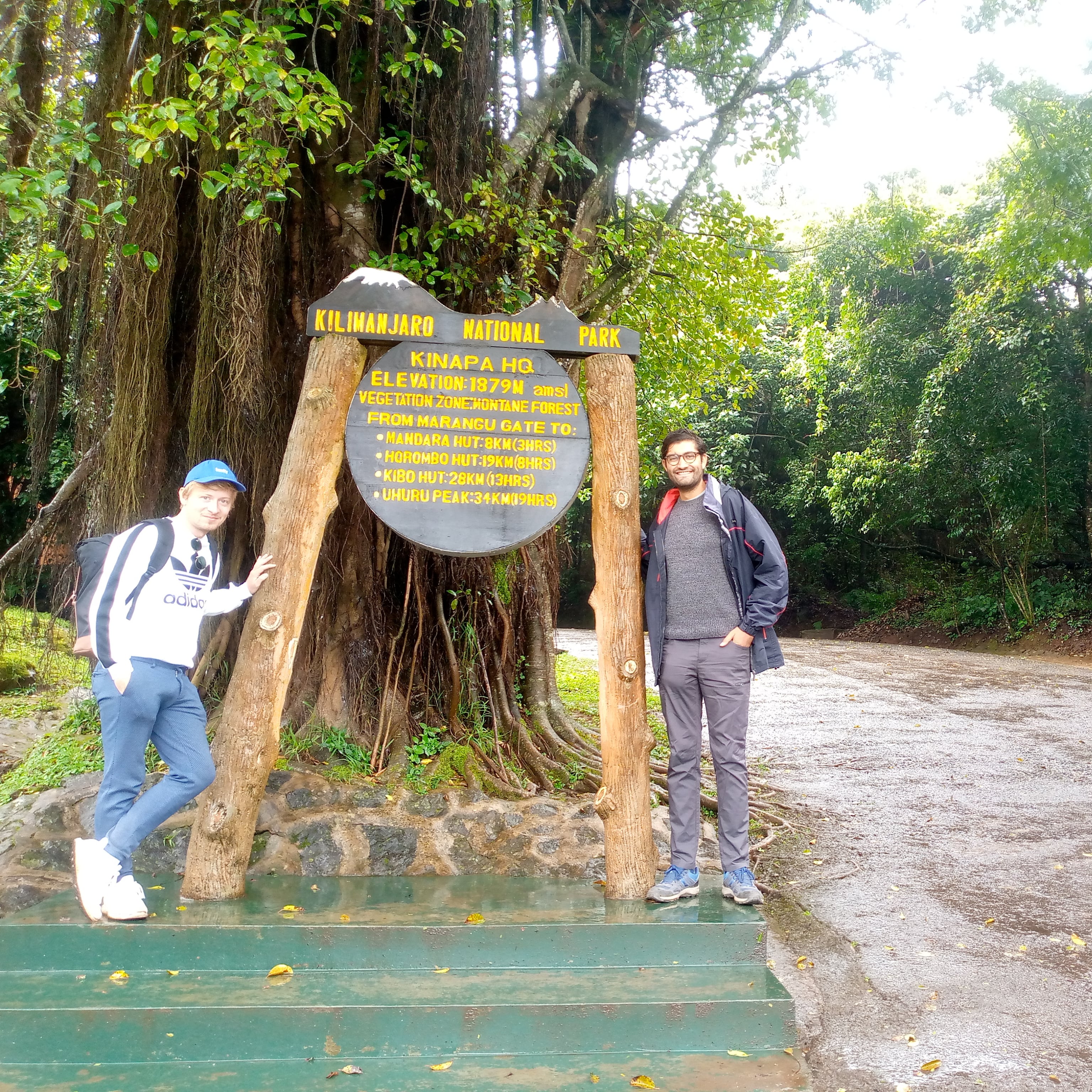
In the morning, after breakfast, we will depart from Moshi and drive to the Kilimanjaro National Park Lemosho gate. Upon arrival at the Lemosho Gate, we will complete the registration for our Kilimanjaro trek.
It will take a little time before the team of guides, chefs, and porters start trekking, as they need to sort out all the equipment for the eight-day climb. Fresh food will be brought from town after three days on the mountain. This is also a good time to have your lunch before starting the trek. The average waiting time can be 1 to 2 hours before we proceed.
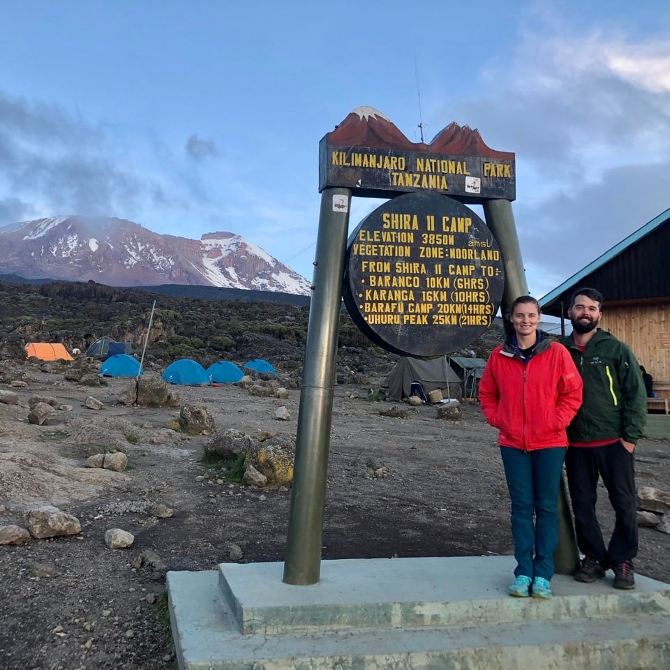
LONDOROSSI GATE TO SHIRA 1 CAMP
Starting elevation 1800m to Londorossi starting point.
Ending elevation 3600m to Shira one (1) Camp
Altitude gain today to 1800m
Trekking distance 3kms
Walking hours 1hours
Overnight hut Shira one (1) Camp
Elevation Zone Rainforest/Montane Forest and moorland
After registration and once the team is ready for the hike, they will call you to take a jeep back to the starting point of the Shira Route, crossing through the thick forest of pine plantations. From the starting point, we will get off the jeep and start hiking.>
From the moorland zone to the caldera of the Shira volcano, we will explore the fascinating rock formations on the Shira Plateau, which will be our camp for the night. This camp provides the best views of the mountain from the western side.
From the Shira Barrier at 3,400 meters, where the walking begins, we will keep moving to Shira One Camp, which is at 3,600 meters. This walk will take about half an hour to one hour. After arriving at Shira One, the team will prepare hot drinks such as coffee, tea, and chocolate to warm up your body while waiting for dinner.
DAY-2: SHIRA ONE (1) CAMP TO SHIRA TWO (2) CAMP .
Starting 3620m Shira One (1) Camp
Ending 3950m Shira Two (2)Camp
Altitude gain today 330 m
Trekking distance 9 km
Walking hours 4-5 hours via Shira peak 3820m
Overnight hut Shira Two (2) Camp
Elevation Zone Moorland and Alpine Desert zone
This section of the trek is shorter and less strenuous than the previous day, allowing for a more relaxed experience. The trail crosses a plateau of grassy moorland and heather scattered with volcanic rock formations. Along the way, you will enjoy spectacular views of Shira Peak, Mount Kilimanjaro, and Mount Meru, with the ever-changing landscape offering a variety of terrain to explore.
The path is adorned with unique vegetation, including the towering Senecio Kilimanjari, which can grow over 9 meters high, as well as strange and fascinating plants such as lobelias, gladiolas, and wild protea. From the top of Shira Peak, standing at an altitude of 3,820m, you will find yourself above the clouds, rewarded with panoramic views of the Shira Plateau and its stunning landscape.
The walk from Shira One to Shira Two serves as an essential acclimatization day, helping to improve your chances of reaching the summit of Kilimanjaro. This shorter day is an opportunity to adjust to the altitude while enjoying the breathtaking scenery that surrounds you.
DAY-3 ; SHIRA TWO CAMP TO BARANCO CAMP
Starting 3950m Shira Two
Acclimatization 4600m Lava Tower
Ending 3920m Baranco Camp
Altitude gain today 980m
Trekking distance 10kms
Walking hours 6-7 hours
Overnight hut Baranco Camp
Elevation Zone Moorland and semi-desert zone
From the Shira Two camp the team will continue east up a steep and rocky trail to Lava Tower Camp 4600m the trek is long and tough for some of the tourists.
The Lava Tower is the big stone left after glaciation to take place. It is normally around this point, where for the first time, some climbers start to feel symptoms of acute mountain sickness such as breathlessness, irritability, and headaches.
The lunch will be at Lava Tower then descend again by almost 680m to the Barranco camp 3920m. Barranco Camp is the camp where you will be rewarded with a beautiful landscape that offers great opportunities to take some beautiful photographs, Barranco camp is the most beautiful camp all over Kilimanjaro, is the huge camp junction about four routes joining together to the same route to the summit, Barranco camp is unforgettable.
DAY-4 ; BARRANCO CAMP TO BARAFU HUT
Starting elevation 3920m Baranco Camp
Via karanga hut 4000m lunch break
Ending elevation 4600m barafu hut
Altitude gain today 680 m
Trekking distance 10 km
Walking hours 5-8 hours
Overnight hut barafu Camp
Elevation Zone Moorland and Alpine Desert zone
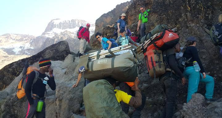
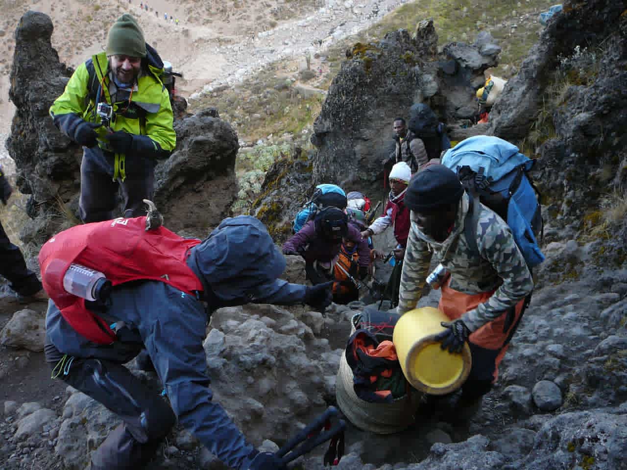
Today’s walk will be tough and long, but the enjoyable afternoon views will make it worthwhile. We begin by tackling the hardest part of this stage: the Barranco Wall. This section involves a bit of rock climbing and may look intimidating at first, but as you approach, you'll find that it offers many zigzag paths that make the ascent easier. It is also commonly referred to as the “Breakfast Wall” since climbers typically tackle it shortly after breakfast.
Once we reach the top of the Barranco Wall, we will find ourselves above the clouds, rewarded with breathtaking views of the Heim and Kersten glaciers, along with stunning landscapes. The remainder of today’s trek from the top of Barranco Wall becomes a bit easier, although it still involves several ups and downs.
As we walk along the ridge, you can experience the beautiful contrasts between desert and vegetation. We will eventually reach Karanga Camp at 3,920 meters, where we will stop for lunch before continuing on to Barafu Camp at 4,600 meters. There is no acclimatization day on the 6-day Machame route. After arriving at Barafu Camp, we will take a short break after dinner before the team wakes you up to prepare for the summit attempt at midnight.
DAY-5 : BARAFU CAMP TO SUMMIT BACK TO BARAFU CAMP
Starting elevation 4600m Barafu Camp
Via Stella elevation 5720m Stella point
Ending elevation 5895m UHURU PEAK
Altitude gain today 1295m
Trekking distance 5-7kms
Walking hours 6-8 hours
Elevation Zone desert zone ice-capped summit
The climb from Barafu Camp (4,600m) to Stella Point (5,720m) is the most mentally and physically demanding section of your Kilimanjaro trek. This leg of the journey typically begins at midnight, under the clear, starlit sky. Despite the difficulty, reaching Stella Point will bring an overwhelming sense of accomplishment—this is the moment when you truly feel that it’s "Kilimanjaro time."
The ascent to Stella Point is long and challenging, but once there, you’ll know the hardest part is behind you. Stella Point marks the top of the crater ridge, but it is not the ultimate summit of Kilimanjaro. From here, Uhuru Peak (5,895m), the mountain’s highest point, is within reach.
The trek from Stella Point to Uhuru Peak takes an additional 45 minutes to 1 hour, and this stretch is significantly easier. Standing at Uhuru Peak, you’ll revel in the incredible achievement of climbing the highest free-standing mountain in the world and the "Roof of Africa." This is the moment to take in the panoramic views, capture memorable photos, and savor your success—but not for too long, as acute mountain sickness (AMS) can occur at these extreme altitudes. A stay of 10 to 15 minutes is recommended before starting your descent.
Descending from Uhuru Peak back to Barafu Camp typically takes 2-3 hours, where you’ll have a short break to rest and recover. Afterward, you’ll continue downhill to Mweka Hut for the night, officially beginning your descent from the mountain. This remarkable day will remain etched in your memory as the pinnacle of your Kilimanjaro adventure!
BARAFU CAMP TO MWEKA CAMP
Starting elevation 4600m Barafu Camp
Ending elevation 3100M Mweka Camp
Altitude Lost today 1500m
Trekking distance 7kms
Walking hours 3-4 hours
Overnight hut Mweka Camp
Elevation Zone moorland and alpine-desert zone
After a well-deserved rest and lunch at Barafu Camp, the descent continues to Mweka Hut (3,100m). The journey transitions through diverse ecological zones, moving from the stark alpine desert and heath zones into the lush greenery of the rainforest. Along the way, you’ll pass through Millennium Camp (3,770m), a brief stop before entering the rainforest.
This day is one of the longest and most demanding, with approximately 16 hours of trekking, beginning at midnight with the summit push. The combination of fatigue and steep downhill walking makes it a test of endurance, but for those who reached the top, it will feel undeniably worth the effort. The views, the sense of accomplishment, and the memories created make it a life-changing experience.
Point to Note: The descent from Millennium Hut to Mweka Hut is quite steep and can be challenging, especially for those with knee issues. However, by maintaining a slow and steady pace, even those with knee concerns can make it to the Mweka campsite safely. Once at Mweka Hut, you can finally relax and share stories of your triumphs with fellow climbers. This is a chance to unwind and reflect on the incredible journey. The hardest parts are behind you, and now, you're preparing for the final descent the next morning. This day marks a major milestone, showcasing your determination and resilience. You've done it – the summit has been conquered!
DAY-6 : MWEKA CAMP TO MWEKA GATE TO MOSHI TOWN
Starting elevation 3100M Mweka Camp
Ending elevation 1820M Mweka Gate
Altitude Lost today 1280m
Trekking distance 8kms
Walking hours 2-3 hours
Overnight hut Moshi Town
Elevation Zone Rain forest zone
The big day has arrived! After seven days of trekking without a shower, everyone is eagerly anticipating the long-awaited hot showers. As you continue your walk, you’ll pass through the lush rainforest, home to diverse species of monkeys and the endemic Impatiens Kilimanjari flowers.
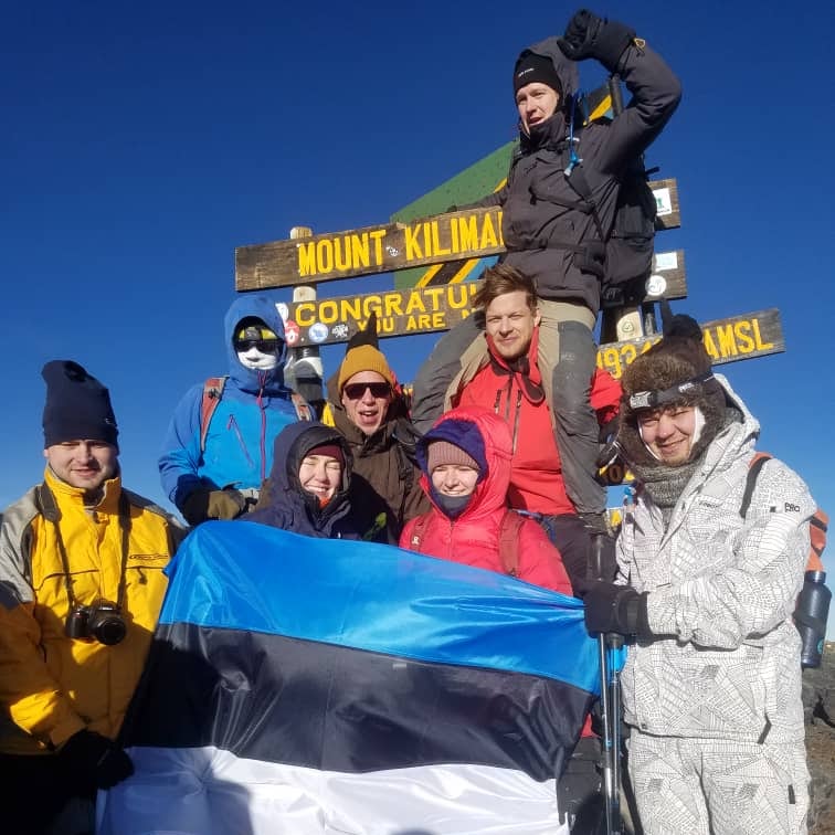
Upon arrival at the Mweka Gate, all climbers will be required to sign out, marking the official end of the trek. For those who successfully reached the summit, there will be a well-deserved certificate of completion to commemorate the achievement. Green Certificates are awarded to climbers who reach Stella Point (5,685m). Gold Certificates are awarded to those who stand at the summit of Uhuru Peak (5,895m), the highest point on Mount Kilimanjaro and the entire African continent.
After receiving your certificate, you'll be driven back to your hotel in Moshi or Arusha, where you can finally enjoy that long-awaited hot shower and a well-deserved celebration. This is also a great time to express your appreciation to the team by handling tips for the guides, chefs, and porters who supported you throughout the climb.
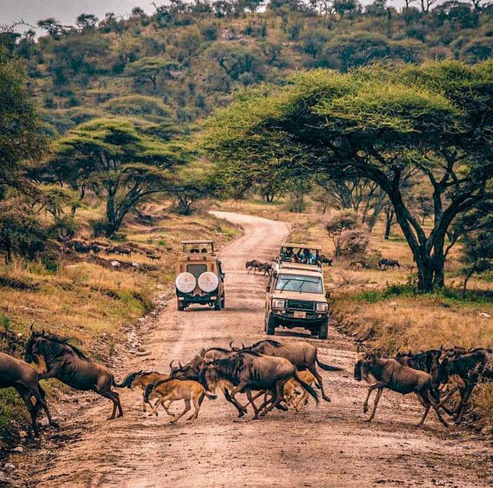
From here, we will assist you with plans for your next destination, whether it's heading to the airport for your return flight or embarking on an exciting safari tour to explore more of Tanzania’s breathtaking natural wonders. The adventure doesn’t have to end here—there’s so much more to discover in this beautiful country!
The tourist will have to pay $2275.00(P/P) price based on 2 person include the following services as it listed on the table below. for any query please call us or send us a message for clarifications from our team. Book This Package Now
Airport pickup on arrival and return on departure time .
2 Nights hotels, meaning full one before climb and after climb.
All transfers to the mountain and back to Moshi town.
Professional, experienced, mountain guides, cookers, and porters
Guides, Porters, and Cooker salaries.
waterproof, four-season mountain sleeping tents (on twin sharing basis).
Sleeping Mattress.
Emergency Oxygen Cylinder.
Three meals on Mountain (breakfast, lunch, and dinner).
Purified or Boilled drinking water while on the Mountain.
Mess tents with tables and outdoor chairs.
VAT (18% ) and All government fees.
Tanzania Visa.
Hotels and Transfers (available as an optional add-on).
Personal trekking equipment such as sleeping bags, hiking boots, clothes, etc (available for rent in here Tanzania too; don't stress if you forget some of the trekking equipment).
Tips and gratuities (Recommended Tipping Amount Per Day; Head guide $20++; Ass.Guide $18++;, cooker $15++;, Summit Porter $12++;, Waiter $12++;,
Porter $10++;).
Portable flush toilet with the toilet tent as an add-on, please see we will need you to pay an extra 150$ per toilet.
Travel insurance.
Personal Expenses (e.g. laundry, telephone, beverages, etc.).
Meals not listed in the itinerary.
Liquors, beers, and bottled beverages.
Lemosho is extremely beautiful and offers a partly untouched landscape as well as varied flora and fauna. Also for the best successful climb.
Machame Route is the second most popular route to summit Mt.Kili after the Lemosho route, the route approaches from south-west.
Marangu route is widely known as a Coca-Cola route due to its easiest and comfortability, the only way offer hut and beds on the mountain.

The Rongai route the easiest route and best during the rainy season since it receives less rainfall compared to other routes.

The Shira route starts relatively high above sea level and is, therefore, a less frequented route as it offers the poorest acclimatization.
Umbwe route is the very Challenging and hardest route to Mount Kili, It is for experienced hikers want to test their fitness.
Definitely climb Kilimanjaro in 7 days Lemosho routes or 5 days Marangu route and 6 days for for other routes like Shira, Rongai, Machame, and umbwe route, Most clients are attached to the shortage of time to spend on the mountain, and very few clients can mention that is Cost savings, again very few of them fall to this point.
Most of the client make the wrong choice due to the lack of enough information about a significantly of acclimatization protocal and summit success rate. Others are fit and they just about to test their fitness and do not like to waste much time on Mount Kilimanjaro, Anyone can pick up this options for their own risk of difficulties and failure to reach the destinations but you need to enjoy from the enterace gate to the end of your climbing, not just the top of the mount Kilimanjaro.
short but steep climb up grassy slopes offers superb views of this wilderness area. The vegetation zone ends shortly as reach a camp.
The Shira route crosses the entire Shira Plateau from west to east in a pleasant, relatively flat hike but has less acclimatization protocol.
Very challenging, steepest, and hardest of all Mount Kilimanjaro routes. this is for experienced hikers want to test their fitness.
Lemosho Route considered to be the most scenic trail on Mount Kilimanjaro but 7 days, in a second day of our climb will be challenging.
Machame route is considered a difficult choice for 6 days since is very challenging and offers the poorest acclimatization protocol.

5 days Marangu route is a shortest and most Cheapest options to climb mount Kilimanjaro but hard and has high risk of failure to climb.